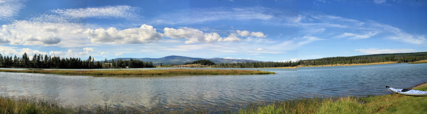
Shuswap Trail Alliance has had 7 years of success in promoting, planning, developing, and maintaining trails (link). We have often remarked that this kind of initiative should also be seen in the Kamloops area. The first steps toward this goal were started this week. A group met to start the first steps. The initial group included the City of Kamloops, Kamloops Indian Band, BC Parks, Recreation Sites and Trails B.C., Tourism Kamloops, Venture Kamloops, Kamloops Outdoors Club, Kamloops Hiking Club, and Kamloops Naturalists Club.
After much discussion, two steps were agreed to.
Formation of a new Society with the founding members coming from the first group.
Agreement to host a General Meeting in the Spring
A committee was struck to begin the incorporation process, to develop an invitation list for the general meeting, to start some core planning, and to begin discussion of goals and foundation statements for the Society. A consensus approach has been adopted and draft documents are already being circulated.
Preliminary statements of purpose shed some light on the direction to be taken:
To promote, support, upgrade, and build self-propelled*/non-motorized trails within the Kamloops Thompson area. * Self-propelled includes walking, hiking, mountain biking, canoe and kayak, skiing, snowshoeing and equestrian travel.
To build an alliance of partner stakeholders committed to sustainable development of trail and waterway routes in the Kamloops Thompson area.
To model and promote ecological integrity and environmental stewardship as a guiding principle throughout the system.
A key concept in the alliance is to consult all stakeholder parties, including motorized recreational users, landowners, lease holders, agencies, and partners. This is an idea whose time is overdue. If you want to get involved, please contact one of the partner groups, or the owner of this website.
We had time to do two separate outings – one on the cliffs and hills to the east, north, and west of Battle Bluff and another on the water around the foot of Battle Bluff.
The two arms of Murtle Lake wind around Central Mountain (see the map in the previous post). From a number of viewpoints, hikers can look down the west arm or the north arm of the lake. To the east is the Wavy Range, with triangular peaks and long rocky ridges. To the north is an endless line of snow and ice covered peaks of the Cariboo Ranges. To the northeast is the source of the North Thompson River, the Premiers Range. Looking past the end of the west arm, the Murtle River winds down the Murtle Plateau. The cone -shaped Kostal Volcano stands above Kostal Lake. Lakes, rivers and ponds dot the landscape. Below the sandbars of Leo Island, where we camped, could be seen under the blue-green lake water (telephoto shot).
The start of the hike is on the north side of the west arm, not far from Leo Island. There is no easy landing at the trailhead. It is a bit of a rocky shoreline, but once ashore, there is room to drag the boat up onto the bank. A sign marks the trailhead and the trail starts a winding route up into the forest. The route is steep and a bit overgrown. The route is 7.5 km each way with a 1037m elevation gain. The trail climbs out of the forest into sub-alpine meadows with lots of wildflowers. The mountain is a sprawling open meadow with rocky outcrops and a few ponds. Travel across the top is quick and hikers will want to find new viewpoints by exploring the open ridges.
If this mountain had easier access, it would see many hikers. It is a recommended hike for those who can travel, portage, paddle, camp, and take a full day to explore the high country.
Once you have launched your canoe or kayak, you will pass through a lagoon for 1.5 km. At this point, you will emerge into Murtle Lake. There are two campsites (Murtle Lagoon) here if paddlers get a late start. The large east bay makes good paddling if the winds are calm, but if not, you may have to stay inside the lee of the bay, making a longer paddle, but a route closer to shore will be less difficult if there is weather to battle. On our last trip, we were able to angle straight for the point on a calm, sunny day.
At the point is a sandy spit and just inside the spit is the next campground. A sandy beach and a good location makes this campground (Sandy Point) a popular spot. There are only 3 designated sites here, but we saw about 8 tents pitched. All campsites have a food cache and pit toilets.
Continuing on, paddlers pass a marshy, forested shoreline. At the indent of the bay, another larger campground (Auther) sits. Turning around the point, paddlers will enjoy Fairy slipper Island. There is no camping here, but it makes a nice spot for a rest or a swim. The West Arm narrows here between Central Mountain and the south shoreline. The hills beyond are rounded, leading on to the Murtle Plateau.
There are 7 campgrounds in the arm. some may already be full. We stopped at each one just to see the site. We talked to some of the campers. Most were close to full except the ones at the far end, but all seemed very nice.
Birch Beach Campground (the first one on the north shore) had 3 sites, but we saw 6 tents. Beyond it, Cottonwood Campground had 2 sites and was full. We paddled onto Leo Island and found that the campsite up on the hill was vacant. Everyone who was already camped on the island wanted to be on the beach so we set up our tents and spent 3 nights here as our base camp.
We paddled down the west arm and checked out the campground at Smoker Island (2 sites). Campers told us that the fishing was best near the islands or in Diamond Lagoon. Beyond the islands is a campground at File Creek (4 sites). There is a 1.5km portage there up File Creek to where boats can be launched upstream. the route is a little marshy but boardwalks help. File Creek is fairly narrow and the area can be buggy, but the terrain opens up further upstream under the slopes of It is possible to hike from the top of navigation on File Creek up to McDougall Lake or beyond to Kostal Lake. This area is very remote and only for the most experienced backcountry explorers. Another 4km trail goes up to Anderson Lake, which will be on our itinerary for our next trip. There is also a trail on the North Shore that goes up Central Mountain which will be a separate story to follow.
The Kostal Campground at the end of the arm was empty, but it had a 4 nice sites and a nice beach. As you approach Diamond Lagoon, you may be alarmed by the current as it sweeps out of Murtle Lake. It is an easy ride down into the lagoon. Stay on the south shore and be sure to stop before the lagoon empties into a series of rapids. A signed landing spot is the start of the 5km McDougall Falls Trail. The secret to getting back up from the lagoon is to tuck in behind the island then paddle hard up the narrow section. Fishing is excellent at this outlet.
The west end of Murtle Lake from high on Central Mountain:
If you paddle the whole west arm and do the hikes, there are a few days of camping here.
Bring your GPS with you when you go for a hike/bike/paddle and it can record how far you have traveled, how much actvity time you had, your average speed or much more. The Trip Computer (or whatever it is called in each type of GPS) can record any of the following that you choose:
Field
Description
Accuracy of GPS
Your estimated position error (EPE)
Battery Level
Battery charge, in 20% increments
Bearing
Direction, in degrees, to the next waypoint
Cadence
Revolutions of the crank arm per minute (for bicyclists using the cadence accessory)
Course
Direction from the last waypoint to the next waypoint
Depth
Depth of water (requires NMEA input from a sonar device)
Distance to Destination
Distance to final destination
Distance to Next
Distance to the next waypoint or turn
Elevation
Elevation above sea level
ETA at Destination
Estimated time of arrival at final destination
ETA at Next
Estimated time of arrival at next waypoint or turn
Glide Ratio
Ratio of horizontal distance traveled to vertical distance traveled
Glide Ratio to Dest
Glide ratio required to descend from your current position and elevation to the position and elevation of your final destination
GPS Signal Strength
Strength of satellite lock, in 20% increments
Heading
Direction you are currently heading
Heart Rate
Heart rate in beats per minute (using the heart rate monitor accessory)
Location (lat/lon)
Location in ddd mm.mmm format
Location (selected)
Location in format set in Setup > Position Format
Odometer
Total distance traveled for all trips
Off Course
Distance to your desired course (use To Course for direction)
Pointer
Arrow indicating direction to travel to the next waypoint or turn
Speed
Current speed
Speed – Maximum
Maximum speed traveled since last reset
Speed – Moving Avg.
Average speed, not including time stopped, since last reset
Speed – Overall Avg.
Average speed, including time stopped, since last reset
Sunrise
Time of today's sunrise at your current position
Sunset
Time of today's sunset at your current position
Temperature – Water
Water temperature (requires external data acquisition device)
Time of Day
Time at your current position
Time to Destination
Estimated elapsed time until you reach your final destination
Time to Next
Estimated elapsed time until you reach your next waypoint or turn
To Course
Direction to your planned course (use Off Course for distance)
Trip Odometer
Distance since last reset
Trip Time – Moving
Time in motion since last reset
Trip Time – Stopped
Time stopped since last reset
Trip Time – Total
Total time since last reset
Turn
The difference in degrees between the bearing to your destination and your current heading. "L" means turn left; "R" means turn right.
Velocity Made Good
Rate of closure to your destination, based on current speed and course
Vertical Speed
Current rate of ascent or descent
Vertical Speed To Dest
Rate of ascent or descent to your final destination
Waypoint at Dest
Name of final destination waypoint
Waypoint at Next
Name of next destination on the current route
You can configure your Trip Computer to record whatever information you wish. These are the ones I prefer for hiking:
Trip Odometer (reset it at the start of your hike, bike, paddle)
You can go out for a hike and bring your GPS and then come back home and download your track onto your computer. You can create an elevation plot, show your route, show your speed, and much more. Here is a plot from a recent off-trail exploration:
In the top image, the blue line represents the route I took. The flags show waypoints that I took along the route (I placed geocaches there).
At the bottom, the red line shows the elevation over time. The blue line shows speed.
How do you do this? The detailed description will be outlined in a separate post, but in a nutshell, here are the steps:
Turn on your GPS at the start of the hike. Enable tracking.
Hike.
At the end of the hike, either turn off Tracking or shut off your GPS. Otherwise you will be tracking your trip home in the car.
Once home, connect your GPS to the computer via USB
Open Google Earth.
Click Tools, then GPS.
In the Import section, pick Tracks and click import.
You should see your route projected onto the Google Earth view.
To get an elevation plot, you need to see the Sidebar. Your track will be Saved in Temporary Places. Right click there and pick Show Elevation Profile.
You can save this view, save as a jpg, email the view, etc. from the same place!
This technology is new, but accessible to everyone.
Salt Spring is the biggest of the Gulf Islands and we have not yet made the time to explore it fully enough. We enjoyed our paddling in Ganges Harbor and Long Harbor. We were impressed by the hiking and camping at Ruckle Park and we enjoyed the hikes on Mount Maxwell, but we have yet to do a dozen or more other spots on this island. We want to return in good weather because our hiking and paddling on Salt spring has been in marginal (rainy and windy) weather.
The hike up Mount Maxwell was fairly steep and in the forest, but the views from the top were very good.
There are several trail options, with the shortest trail distance of 6km and the longest up to 15km.
We found Ruckle Provincial Park to be a special place. Whether your choose to hike, paddle, camp, or walk, there is a wide variety of views:
Leave a whole day to explore this area, if you can.
There are 15km of trail here, including 7km of shoreline.
Paddlers can base out of Montague Harbor or can launch from many sites on the island. Routes down to shoreline offer explorations. Two are featured here:
Bellhouse Provincial Park is a small park near Sturdies Bay with a short trail but with interesting sandstone formations:
Dionisio Provincial Park is accessible by boat only and paddlers will have to pay attention to tidal charts to enter any part of Porlier Pass. Beaches, headlands, trails, camping, and exploration makes this a destination spot.
An overview of this area can be found at the Parks BC site:
We will continue to return to Galiano Island for a late winter retreat to hike and explore, and in summer to camp and paddle. Galiano is the first stop on the Southern Gulf Islands Ferry from Tswassen. Once the ferry is launched, you can be offloading at Sturdies Bay in an hour. We prefer to head inland down the long narrow island to Montague Harbor. We find this area to be central for our explorations, hikes and paddles.
Montague Provincial Park
Montague Provincial Park Campground is usually rated in the top 3 in the province. The camping is in a beautiful oceanside setting with several beaches, hiking trails, and easy access to Trincomali Channel. If you want to camp here, you will need to book this very early to get a site. One part of the campground, though, is for cyclists and paddlers only and it never seems to fill up. In later winter, the 3km of hiking has a number of options include a beach walk, a reef to explore at low tide, 6 middens, a salt water marsh, and a boat harbour. There are many fine views, so bring your camera.
Take the time to explore the shoreline around Gray Point.
In summer, it is easy to get the kayak right to the water and lauch from the beach. We found that a morning paddle worked best because the winds come up by noon each day. From Montague beaches and launches, you can paddle out to numerous islands. Most are privately owned, but we found some oyster-covered coves to land on the islets (not at high tide). We enjoyed paddling around the Ballingel Islets which is an Ecological Reserve for cormorants. It is possible to paddle all the way to Wallace Island, but it would be easier to launch at Retreat Cove, north on the island road.
The coastline has many sculpted features. Taking a photo while kayaking is never easy, but in calm waters it can be done.
Montague is wonderful place to visit, but there a number of other areas that are rewarding – Bodega Ridge, Mount Galiano, Bluffs Park, Dionisio Point, and Bellhouse Park. The next posts will feature some of these.
In two previous posts, Mount Warburton Pike and East Point Park were featured. There are lots of opportunities to hike and paddle on Saturna and a few are noted here.
Winter Cove Park
This point of land is within the National Park Reserve. There are about 1.5km of hiking and some shoreline viewpoints. Winter Cove and the shores around Samuel Island make good paddling.
This narrow channel separates the island from Samuel Island. You can paddle through this channel, but it is best to check the tide charts since the water surges through the narrow spot.
Taylor Point
Did you know that there was a vineyard on Saturna Island? We have tried the wine and we visited the vineyard (a steep hill so check your brakes) in winter, though it was closed. A rough hike goes from the end of Trueworthy Road all the way to Taylor Point. This hike should not be your first choice since it winds across bluffs on an 8km return hike. Saturna Beach is along the west coast accessed from this same general area.
Narvaez Bay
We enjoyed riding our bikes down the length of the island then down to Narvaez Bay and back. At Narvaez Bay, we hiked 2km around the points.
There are numerous short trails and routes down to small beaches, reefs, and viewpoints. We enjoyed Fiddlers Cove, Saturna Beach, Boot Cove, and Monarch Head.
Tumbo and Cabbage Island
Launching from East Point, Tumbo Island is only about 600m across the channel. There is lots of paddling, hiking, and exploration around and on the islands. There are a few camping spots on Cabbage Island and this is on our return trip "to-do" list
If you travel to Painted Bluffs Provincial Park on the north shore of Kamloops Lake, you can hike into the bluffs, and when you do, you will be stunned by the "other-wordly" feeling of the shapes and colors in front of you. Eroded, sinuous multi-colored slopes drain the slopes above, channeling water into one stream gully above the alluvial fan. You can hike up onto the narrow ridges on the slopes, finding various vantage spots for your explorations.
What do we know about this area?
Very little geological information is available on this area. What we do know is that the bluffs have distinctive multi-colored rocks and soils on an intrusion of batholithic rocks.
A batholith is a large zone of molten rock under the surface of the earth that cools over time.
An intrusion is an arm of the batholith that has risen to the surface and cooled, forming minerals in the process.
Batholithic intrusions often stand out (are discordant) from the local geology.
The bluffs have been eroded into distinctively-shaped barren ridges and gullies, all leading down to a fluvial fan.
Fluvial fans are formed by the movement of water bringing materials down stream.
Alluvial fans are formed when a stream course suddently widens and flattens. Materials are deposited in a fan shape.
The hillsides surrounding are covered in big sagebrush and bluebunch wheatgrass. California bighorn sheep frequent the ridges. The colors off the bluffs are intriguing. Deposits of mercury, copper, and cinnabar have altered the hues of these materials.
Mercury was raised to the surface through the intrusions and cooled in cinnabar formations. Most mercury deposits around the world are found in cinnabar.
Cinnabar (mercuric sulphide) is the common ore of mercury.
Cinnabar is usually brick red to crimson in color. It is an ingredient used in red pigments.
Copper is an ore common to the area (ie Copper Creek).
Copper compounds are often found as salts of copper, and impart a green or blue color.
Climb the ridges to enjoy the sinuous shapes:
Watch for California bighorn sheep:
Most of all, bring your camera and put yourself amongst the bluffs:
Hike or paddle there, but plan on staying long enough to explore the park.
If you don't set goals and targets for your efforts, you won't set aside the time and effort to explore new areas. A new area takes time to research, time to prepare, time to travel to and from, and will probably take longer than planned if you are exploring new territory. For some areas, there is no information, so you have to commit to exploration in spite of many unanswered questions. For other areas, conditions will limit your efforts – snow, rain, heat, cold, bugs, mud, road access, forest fires, deadfall, vehicle problems. For these you have to match up the trip to the conditions, and cancelations could be the result. A "Plan B" will be needed. So many people are fair-weather hikers. Should we brave the elements and just persevere?
We make a plan and pick dates, then the conditions don't cooperate. Since we need to get out, we have learned to have a backup plan. Except in the coldest or wettest conditions, there can always be a Plan B. In the Kamloops area, we don't lose many days. If we are planning to go to the alpine, though, decent weather is needed, so hillside hikes or bikes, or a paddle are in our "alternates list." When the winds howl, we put away our paddles, and find the forest. When the bugs swarm the high country, we paddle on open water or hike on open ridges. On a hot day, a mountain bike on a backroad is a good choice. On an overcast day, a paddle around the shoreline of smaller lake is a good choice. Since geocaches can be in any location, a caching journey can provide interesting outdoor experiences. With so many alternatives, should we just stick to Plan B routes?
To explore new areas, to challenge ourselves, to widen our knowledge of our environment, and to be a part of the natural history of our world, we need to set out goals and plan for trips, journeys, tracks, and trails. We can make our own private lists, or we can share them. We can personally commit to our list or we can invite others to join us. We can show leadership, or we can follow others. We can keep our experiences private, we can share them, or we can celebrate them.
It is impossible to do them all. There are just too many trails, routes, ridges, backroads, rivers, meadows, scrambles, lakes, coastlines, caves, hills, and tracks. And, of course many trails need to be visited many times. Wells Gray, the Dewdrop Ranges, Lac du Bois Grasslands, Lac le Jeune, Rogers Pass, the Trans Canada Trail, Garibaldi Lake, the Great Divide, Cathedral Lake, and many more areas have to be experienced many times. We can't imagine a year when we don't hike to Trophy Meadows or paddle the North Thompson River.
So, each year we set goals and try to do as many as possible. In the end, some carry over to a new year and we finish half of our list, but others get added. Over many years, the total list of tracks and trails is a long one. Many of them now are reflected in posts on this website, but there are also many that haven't reached publication yet.
So, for 2011, our resolution is to hit as many of our goals as possible:
There are a few hikes that hikers travel to from all over the world. We will complete one of these this year – The Kalalau Trail along the NaPali coast on Kauai. There are also world-class hikes in Kokee State Park and Waimea Canyon State Park. We have done some of them already, but we will be looking to do the Kukui Trail, the Awa'awaphui Trail, the Alakai Swamp-Pihea Trail, the Waimea Canyon Trail, and the Jungle hike under Mt. Waiaiele.
We have paddled the North Thompson River many times and have even camped on islands on an overnight trip. We think that a trip from Clearwater to Kamloops with one or two nights on the river will be in our 2011 plans.
We have also paddled the west arm of Murtle Lake, but we have not yet paddled the north arm. This trip is high on our list. A fall trip on Clearwater and Azure Lakes is an alternate (both would be better).
We have biked or walked many sections of the Trans Canada Trail, but we want to add more sections. The section from Hope to Chilliwack is in our sights.
Exploring new areas that have almost no information is always on our list, but sometimes it is a success, and sometimes just doesn't work out. We keep a few on our list. The ridge extension on Red Plateau from the end of the Dewdrop Trail to the end of Hardie Hill is on our list. We can see that it can be followed on logging roads, but we are looking for hiking and biking alternatives along the rim of the ridge too.
New rivers to paddle are on our list. We are looking at other sections of the Shuswap River, the Eagle River, and the Fraser River (north). Rivers can be safe or hazardous, depending on the time of the year. The North and South Thompson Rivers are safe year round, but at high flood, attention must be paid to logjams, sweepers, sideslides, and rapids. When rivers become Class 3, we have to make sure we are ready, well-equipped, and with the right group.
Mountains to hike in 2011 include the ridges up to Dunn Peak, Trophy 3, Table Mountain, Needle Peak, Stoyama Mountain. Thar Peak, Queest Mountain, Pukeashun Mountain, Tsuius Mountain, Mt. Bowman, Mt. Kerr, ….
Areas to explore and populate with geocaches include the Roche Lake area, Wells Gray trails, the Masters Subalpine Walk, Tranquille Canyon, and any mountain top that requires a hike or scramble to get to the top.
We still haven't yet explored the right place for the Petrified Forest in the Monte Hills or the natural arch in the Dewdrop. There are numerous lakes to explore and photos to take.
The Rockies call to us every year and many are in our return list – Cauldron Lake, Bow Hut, Floe Lake, Skoki, Egypt Lake, Maccarib Pass, Upper Fish Lakes, Carthew Summit, …..Too many too far apart….
The sea calls to us and our ocean-going kayaks will see at least one journey on the waves.
Our bikes have many backroads to explore. We also want to do at least one section of the Kettle Valley route each year.
And, we are open to invitations to join others who can share their favorite places with us.
In reflection, it appears we will need to retire to meet our goals for 2011.Plan B is to do as many as possible and finish the list in 2012!
This site feels prehistoric, other-worldy, unique.
The combination of shapes and colors makes this a very special place. Its quite close to home, but hard to get to.
Route Choice One – Go past Savona and turn onto the Sabiston Creek Road. Follow it to the Copper Creek Road and descend towards the lake. You will come to private property. You can proceed and ask permission to cross the property and if you do, park near the railroad tracks. If you don’t want to ask for permission, you can park above the property and traverse the sidehills for about a kilometre. There is no trail and there are some fences. If you can park at the lake, the Bluffs are to the east and you have to either go through the train tunnel (not recommended), around the shoreline on rocks (boulder hopping), or climb over the hill (scramble). None of these routes are long but all involve some rough terrain.
Route Choice Two (recommended). Launch your boat from Savona or from Tobiano and paddle across the lake. Crossing the open lake on a windy day is not recommended so either wait for a calm day, or hug the shoreline to the river mouth and paddle up the shoreline. The paddle across from Savona or Tobiano is about an hour. There is a sandy/gravel beach to land on. Beach your boat, put on your hiking boots, and head north up the gully. Cross the tracks and start your exploration.
Once you arrive at the spot, you can explore the eroded canyons, ridges, and boulder slopes. Bring your camera and your sense of wonder. This site is one of the “Seven Wonders of Our Area.”